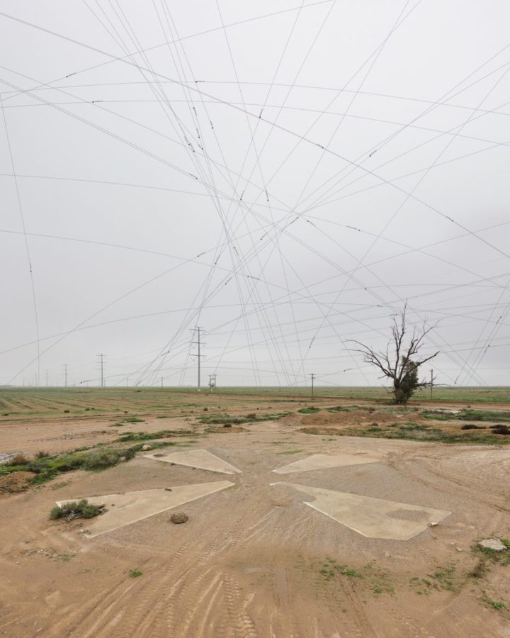
There is a 16-by-16 mile grid of big X’s in the Sonoran Desert that were used to calibrate spy satellites in the 1960s. They’re no longer in use, but Julie Anand and Damon Sauer have been studying the marks and overlaying the paths of publicly-known satellites that are detected during the time of a photograph.
Satellites from the ground
Second Edition
 Visualize This: The FlowingData Guide to Design, Visualization, and Statistics (2nd Edition)
 Visualize This: The FlowingData Guide to Design, Visualization, and Statistics (2nd Edition)
New tools, refined process.