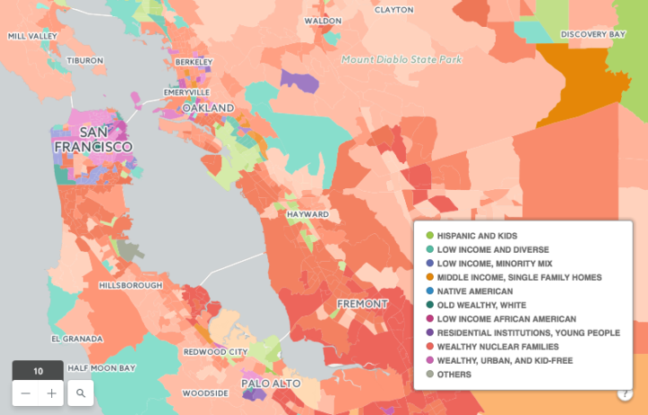
Geographers Seth Spielman and Alex Singleton used something called “geodemographic classification” to classify small areas based on demographic averages.
[F]or example, we can identify places dominated by small apartments occupied by single city dwellers from those family residences and larger detached homes. The techniques are very popular in industry for customer segmentation – with logic following that our purchasing behaviour is influenced by where we live.
So it’s not just mapping race, age, or housing individually. Instead, the method provides much more detailed and descriptive clusters. Then, CartoDB recently made an interface to search and browse the data.
 Visualize This: The FlowingData Guide to Design, Visualization, and Statistics (2nd Edition)