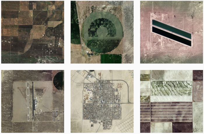
Named after the grid system Thomas Jefferson used to apportion land acquired through the Louisiana purchase, the Jefferson Grid Instagram account highlights remnants of the system through satellite shots from Google Earth. Each picture is the land that fits into one square mile.
The most fun ones more me are the desert shots. It’s a square mile of development and just dirt everywhere else.


