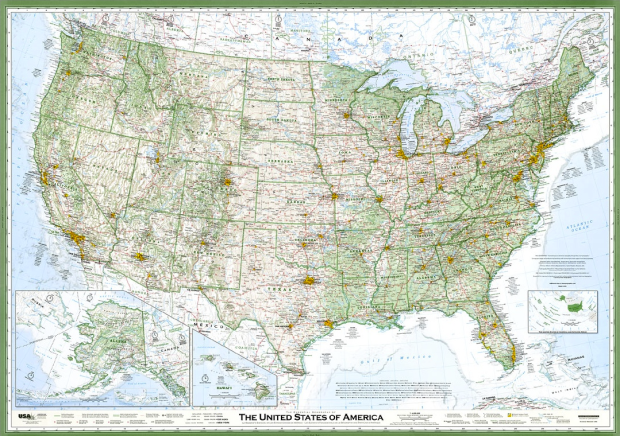
Seth Stevenson, for Slate Magazine, covers cartographer David Imus’ hand-crafted wall map, which Stevenson calls the greatest paper map of the United States you’ll ever see.
American mapmaking’s most prestigious honor is the “Best of Show” award at the annual competition of the Cartography and Geographic Information Society. The five most recent winners were all maps designed by large, well-known institutions: National Geographic (three times), the Central Intelligence Agency Cartography Center, and the U.S. Census Bureau. But earlier this year, the 38th annual Best of Show award went to a map created by Imus Geographics—which is basically one dude named David Imus working in a farmhouse outside Eugene, Ore.
What makes it so good? Zoomed out, it doesn’t look much different from other maps. Zooming in, however, you see something that was carefully crafted by hand. Below is a side-by-side comparison of Chicago on the Imus map (left) and a National Geographic map (right). Disregard the fuzziness in each, as that’s the product of a scan. On one you have forestry shading, straight labels, and more emphasis on locations than on interstates. The other reads more like a road map.

I’m not so much a cartographer as I am someone who puts data on maps, but I can appreciate the thought and care put into each placement like I can appreciate a data graphic designed by someone who knows their data well. Calling it the greatest ever is a tough sell though. I’d be interested to hear what you cartographers think.
The map is available in print at Imus Geographics. Hey, you can even get it laminated.
[Slate | Thanks, Claire]
 Visualize This: The FlowingData Guide to Design, Visualization, and Statistics (2nd Edition)
Pretty interesting map, but I’d be damned if I spent that much time working on it!
As for a cartographer’s opinion on it…. check this out…. http://cartonerd.blogspot.com/2012/01/good-map.html
makes me wonder how does one define a map as being great? what are the qualities of a great map? density of information? legibility? clarity? accuracy? aesthetics?
As someone who makes maps for a living, I can tell you it mostly deals with clarity and accuracy of information/spatial phenomena, effective symbology, as well as a number of map policies and typographic techniques. If this was done by hand, I’m astoundingly impressed. Transferring any 3-dimensional object on to a 2-dimensional surface requires a great deal of complex mathematical computations called a map projection. Best map ever? I’m no authority to answer that, but I can tell you this is one hell of a map I would love to have a copy of.
Not sure I can embrace the use of ALL CAPS for so many labels, it adds clutter. Add in the bold, and you have the name CHICAGO stretching all the way across the lake…
Straight labels are a big plus other than along crooked features, such as rivers, and forestry shading emphasized over colorful political boundaries is another winning decision.
It sports improvements, but I’m not ready to endorse Stevenson’s pronouncement.
This is going to sound like a weird compliment, but his map reminds me of those old rolldown windowshade maps I had at school. I went to a really old school (150+ yo now) and the maps were yellowed and ancient and markings for war campaigns/marches, politcal movements, and sometimes they were fantastically outdated with old political boundaries that were long gone. His map looks like that. Beautiful.