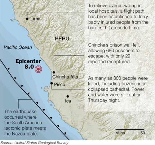
A huge 8.0 earthquake shook Peru a few days ago killing at least 510 people. Homes and buildings were destroyed and many people’s lives were changed forever. I’m ashamed to admit that if it weren’t for my internship, I probably would have never even known about the quake. I hope a lot of help is headed towards Peru.
This map graphic was a bit tricky because it was made for color in the paper. That means the color layer and text layer had to be split and sent separately to the printers. It’s this odd process, that I’m afraid I don’t quite understand, but the color printers are in a different place than the black and whites. The color part gets printed, and since the text and color is separated, there’s still time to make any last minute changes to the black and white. Uh, scratch that. That’s probably wrong.
One of the map people provided me with the base map and then I filled in the blanks i.e. everything that isn’t land and water, and after about one billion back and forths I finally set it and was able to leave a couple hours later than usual. To top things off, some of the text was different in the paper today than I had put in.
 Visualize This: The FlowingData Guide to Design, Visualization, and Statistics (2nd Edition)