Last year, WNYC made an interactive map that shows transit times in New York, based on where you clicked. Geography graduate student Andrew Hardin expanded on the idea for San Francisco, Seattle, Boulder, and Denver, with additional options and more granular simulations.
You can select the time of the day and day of the week, because as we know, transit schedules change, so you can get a more realistic estimate of how long it takes to get from point A to point B.
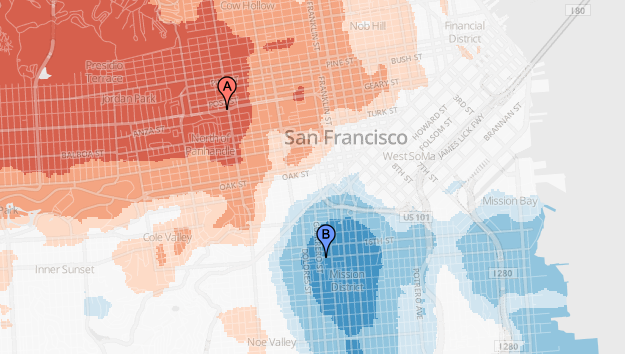
There is also an interesting comparison option, which lets you choose two locations to see which area will get you somewhere else faster. For example, let’s say you plan to walk from point A to to point B, or vice versa, and have a third destination in mind. This comparison would help you plan accordingly.
See the paper [pdf] for full details. The key here is the data, which includes multiple transit types, used to run simulations and the simulations themselves.
 Visualize This: The FlowingData Guide to Design, Visualization, and Statistics (2nd Edition)