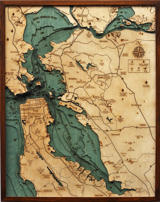
Below the Boat produces beautiful laser-cut wood maps:
Starting with a bathymetric chart (the underwater equivalent of a topographic map), the contours are laser-cut into sheets of Baltic birch and glued together to create a powerful visual depth. Select layers are hand-colored blue so it’s easy to discern land from water, major byways are etched into the land, the whole thing’s framed in a custom, solid-wood frame and protected seamlessly with a sheet of durable, ultra-transparent Plexiglas.
They should go all the way with it and do “above sea level.” [via kottke]


One of the Grand Canyon could be amazing!
Next gift for my self :))
Lattitude Kinsale makes similar 3D charts: http://www.latitudekinsale.com/