
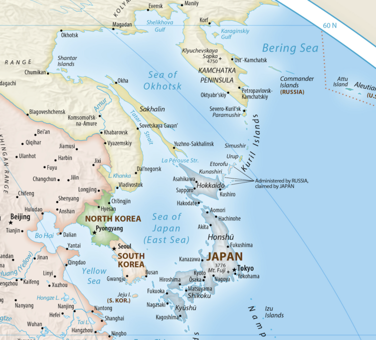
The United Nations voted to support the Equal Area map projection, which more accurately shows the size of Africa than the Mercator projection. However, Japan has requested a revision, because the Kuril Islands is shown to belong to Russia. For the Guardian, Agence France-Presse reports:
Japanese government spokesperson Minoru Kihara on Thursday said the new map – known as the Equal Earth cartographic projection – “contained a depiction contradicting the Japanese government’s position”.
“We lodged a protest with the map site’s operator through our diplomatic channel to demand the correction of this depiction,” Kihara told reporters.
He declined to say when the issue was brought to government’s attention but said Japan “needs to prevent misconceptions of our territories and geographical names from spreading”.
The disputed islands were seized in 1945 by the former Soviet Union, which then expelled the Japanese population.
There are those trade-offs again when abstracting reality.
 Visualize This: The FlowingData Guide to Design, Visualization, and Statistics (2nd Edition)
