
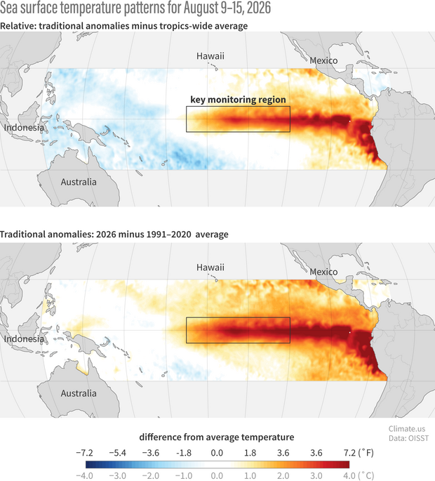
For Climate.us, Emily Becker explains why it looks like El Niño is going to break records this year. Current estimates from NOAA adjusts for the ocean warming overall.
Our old yardstick was telling us whether the El Niño region was warmer than average, but not if it was significantly warmer than other parts of the tropical oceans. Now we made a new yardstick: the Relative Niño-3.4 index, which is the original-flavor Niño-3.4 anomaly minus the average anomaly over the entire tropical oceans. Subtracting out the tropics-wide anomaly helps us understand El Niño’s true strength in a warming world. It’s very likely that this year’s action in the tropical Pacific is El Niño plus some climate change. To get just the ENSO part of the signal, we look at the Relative Niño-3.4 index.
It’s not obvious at a glance, but with the new model (top), you can see the stronger difference between blue on in the west and red on in the east. More variation leads to stronger El Niño.
 Visualize This: The FlowingData Guide to Design, Visualization, and Statistics (2nd Edition)
