Jon Keegan of Beautiful Public Data highlights researchers who used lidar to estimate fire damage in Southern California.
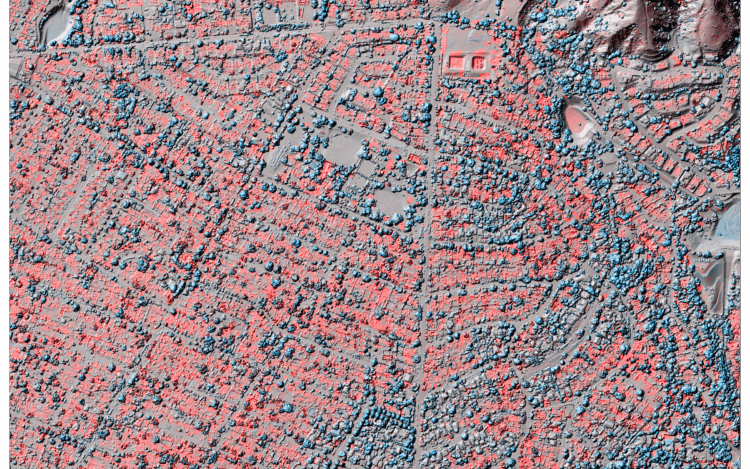
“We said, what would be a useful product for people to have as quickly as possible, since we’re doing this a couple weeks after the end of the fires? And we thought trying to get as high of a resolution and as kind of as differencing as possible would be a good idea,” said Brigham. Her team cleaned and reformatted the older, lower-resolution data and then subtracted the newer data. The resulting visualizations reveal the scale of devastation in ways satellite imagery can’t match. Red shows lost elevation (like when a building burns), and blue shows a gain (such as tree growth or new construction).
 Visualize This: The FlowingData Guide to Design, Visualization, and Statistics (2nd Edition)