Inside out map of the Grand Canyon
Jan 17, 2019

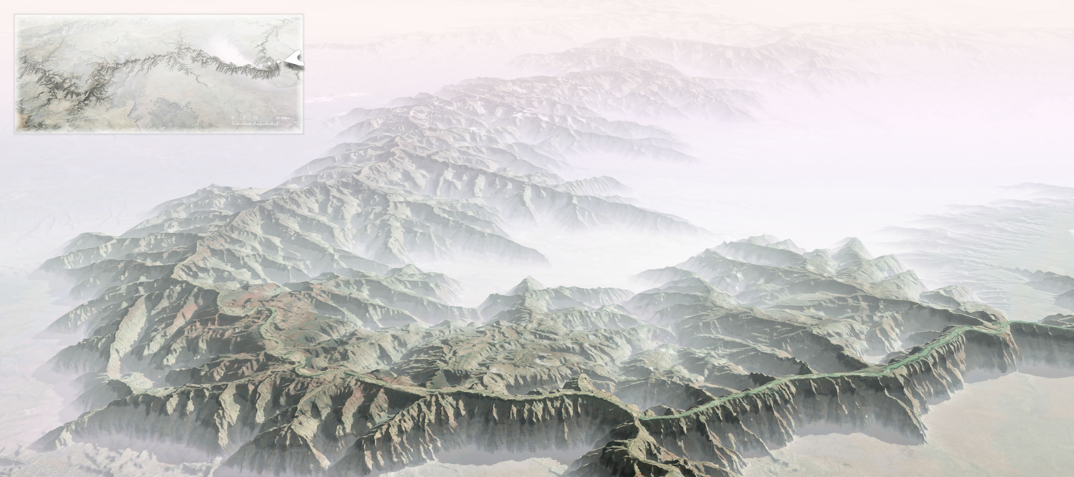
John Nelson turned the Grand Canyon inside out to understand the magnitude better:

Some of my earliest memories of the place had to do with the trippy feeling of my eyes and mind trying to make sense of the scale. I had seen many mountain ranges and vistas, including some on the way, but the vast negative space played havoc with my perception of magnitude. I’ve felt it a few times since, but never like that first Grand Canyon overlook.

Instructions included on how to do this in ArcGIS Pro.

Become a member. Support an independent site. Make great charts.

See What You Get

Favorites

What Qualifies as Middle-Income in Each State

The meaning of “middle-income” changes a lot depending on where you live and your household size.

A Day in the Life: Women and Men

Using the past couple of years of data from the American Time Use Survey, I simulated a working day for men and women to see how schedules differ. Watch it play out in this animation.

The Best Data Visualization Projects of 2014

It’s always tough to pick my favorite visualization projects. Nevertheless, I gave it a go.

All the Household Types in the U.S.

No need to restrict ourselves to the most common types. There are thousands. Let’s look at all of them.