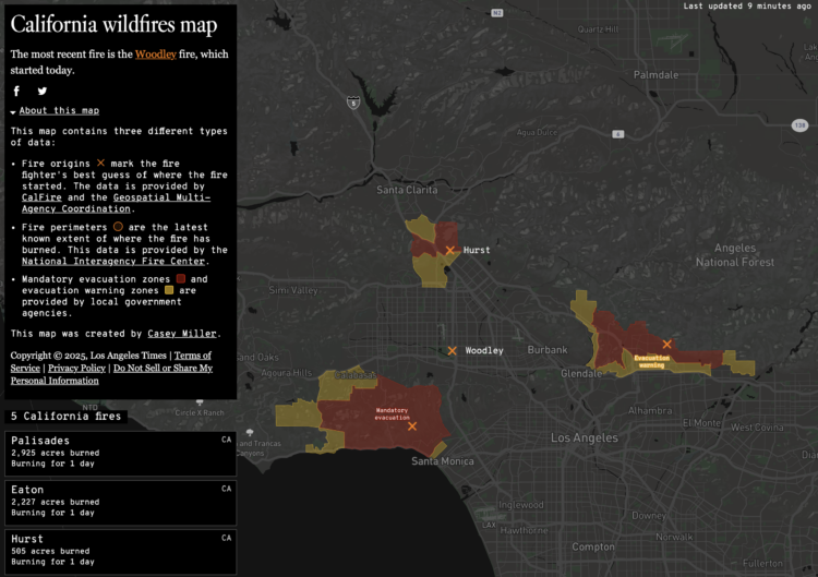
This California wildfires map from Los Angeles Times shows an up-to-date status in the Los Angeles area. It provides fire origin, perimeters, and evacuation areas. I hope everyone is keeping safe.
The original by Casey Miller was made in 2020, when a lot of California was burning. There were a couple more map layers for pollution and an aggregated view, but it’s good to see the app still running.
Incident data comes from Cal Fire, which makes the data available as CSV and via API. The data goes back to 2016. Props to them for running and maintaining a usable data feed for almost a decade.


