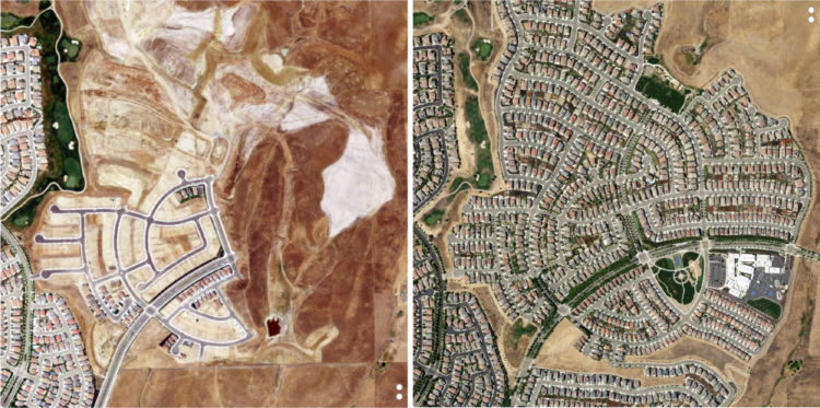
For The Upshot, Emily Badger and Quoctrung Bui looked for major urban developments in the United States by comparing satellite imagery of past to present:
To grasp the scale of this decade of change, The Upshot worked with Tim Wallace and Krishna Karra from Descartes Labs, a geospatial analytics company, using a tool that has itself evolved significantly over this time: satellite imagery. With its growing power and precision, we can see both intimate details — a single home, bulldozed; a tennis court, reinvented — and big patterns that recur across the country. Here, we show some of the most consequential changes over the last 10 years, as seen from above.
The resolution is impressive (but still creeps me out a little bit). And while maybe not as fun to watch as a time-lapse, the two-snapshot treatment provides more contrast, which makes it easier to see the change. I also like the two small dots on the right of each image to indicate progress while scrolling.


