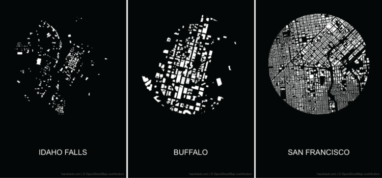
In visual perception, a figure-ground grouping is where you recognize an object through the background. Think of the vase and two faces image. Hans Hack made a simple tool that lets you make such a diagram using OpenStreetMap data. Select a location in the world, adjust the radius of the circle, provide a label, and voilà, you have yourself a poster. Download it as an image or SVG file.
Make a figure-ground diagram using OpenStreetMap data
Second Edition
 Visualize This: The FlowingData Guide to Design, Visualization, and Statistics (2nd Edition)
 Visualize This: The FlowingData Guide to Design, Visualization, and Statistics (2nd Edition)
#/media/File:Cup_or_faces_paradox.svg)
New tools, refined process.