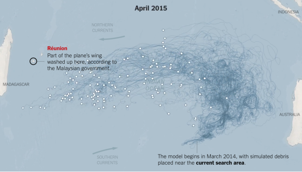
Malaysia Airlines Flight 370 went down a year ago, and with recently found debris that is possibly from the flight, researchers have a few more bits of data to work from. The New York Times picked up on coverage of what’s going on, and in the latest, they provide an animated map that shows possible routes the debris could have taken. This is based on computer models from the Commonwealth Scientific and Industrial Research Organisation, and suggests a search area.
Possible float routes for Malaysia Airlines Flight 370


