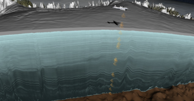
I don’t know exactly how much data NASA has in the bank, but I think it’s a lot. Explained in the video below, they estimated the age of ice layers in Greenland by flying a plane over the Greenland Ice Sheet and pulsing radar to gather information.
Mapping ice layers with radar data
Second Edition
 Visualize This: The FlowingData Guide to Design, Visualization, and Statistics (2nd Edition)
 Visualize This: The FlowingData Guide to Design, Visualization, and Statistics (2nd Edition)
New tools, refined process.