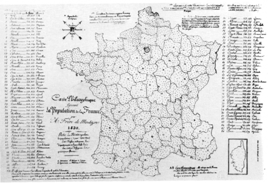
I’m admittedly not very good with historical precedent, but I think we can all agree it’s important to know about the work those have done before us. It makes your own work better and lets you appreciate what others do more (or less).
To that end, Zach of indiemaps has a fine roundup of the very first thematic maps. The first known choropleth map? That would be Charles Dupin’s from 1826 (above).
How about the first dot density map from Frère de Montizon in 1830?

Check out indiemaps for more. Also find a complete history of data visualization here.
[via TomC]


Hypergeo confirms that Charles Dupin (1784-1873) was the first to use “dyed maps” as he called it, in 1826. The first map shown here was published in 1827 as part of “Forces productives et commerciales de la France”.
The interesting thing is its underlying colour psychology: départements with a low level of public instruction are shown in dark colour, because they still remained in the Dark Ages of Ignorance, whereas those with a higher level of instructed are more “enlighted” which translates into lighter colour.
See http://www.hypergeo.eu/article.php3?id_article=274
hehe, dark color for the “dark ages of ignorance.” i like that.