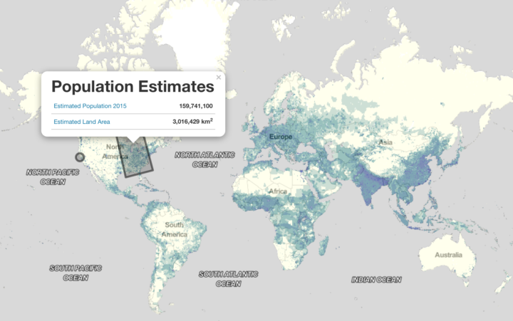
Population data typically comes in the context of boundaries. City data. County data. Country data. With their Population Estimate Service, NASA provides data at higher granularity. You can request estimated population in the context of a world grid.
Here’s an interactive map to demonstrate the API. Click and drag a shape across any region in the world and get an estimate of the population within that shape. [via kottke]
 Visualize This: The FlowingData Guide to Design, Visualization, and Statistics (2nd Edition)