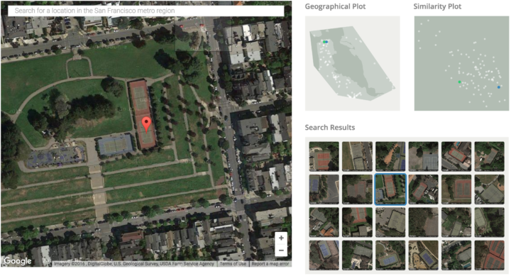
Terrapattern is a fun prototype that lets you search satellite imagery simply by clicking on a map. For example, you can click on a tennis court, and through machine learning, the application looks for similar areas.
Terrapattern uses a deep convolutional neural network (DCNN), based on the ResNet (“Residual Network”) architecture developed by Kaiming He et al. We trained a 34-layer DCNN using hundreds of thousands of satellite images labeled in OpenStreetMap, teaching the neural network to predict the category of a place from a satellite photo. In the process, our network learned which high-level visual features (and combinations of those features) are important for the classification of satellite imagery.
 Visualize This: The FlowingData Guide to Design, Visualization, and Statistics (2nd Edition)