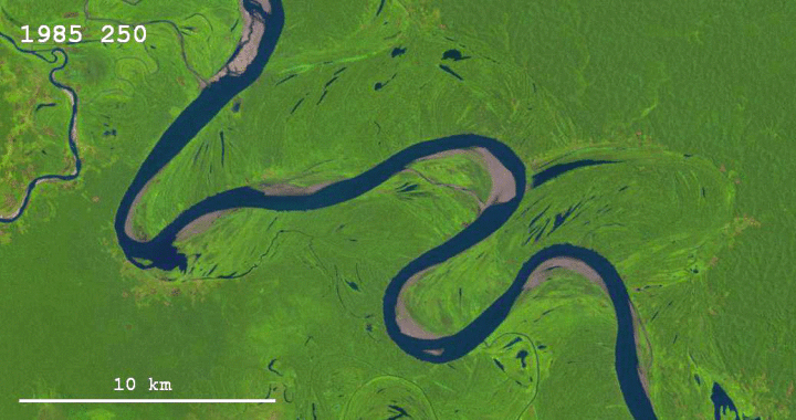
Sedimentary geologist Zoltan Sylvester downloaded Landsat data using Earth Explorer and strung together images of the Ucayali River to see the changes over thirty years.
Thanks to the Landsat program and Google Earth Engine, it is possible now to explore how the surface of the Earth has been changing through the last thirty years or so. Besides the obvious issues of interest, like changes in vegetation, the spread of cities, and the melting of glaciers, it is also possible to look at how rivers change their courses through time.
Yeah, I’m gonna have to look at other areas of the world now. Brb.
 Visualize This: The FlowingData Guide to Design, Visualization, and Statistics (2nd Edition)