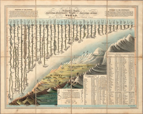
I had no idea these comparative views of length of rivers and heights of mountains were so popular – at least in the 1800s. There seemed to be a fascination with placing rivers and mountains next to each other when normally, we’re used to seeing them intertwined in a geographic landscape. The above is actually just river lengths, but here’s one that places rivers and mountains next to each other.

The results are pretty effective and nicely drawn. I’ve always wondered what maps looked like before computers. Paper? Pencil? I do not understand what you are talking about. Me use… machine.
[via BibliOdyssey | Thanks, Jason]

 Visualize This: The FlowingData Guide to Design, Visualization, and Statistics (2nd Edition)

Pingback: Comparando: longitudes de rÃos y tamaños de montañas | JoltivanNet - Ultimas Noticias de Ciencia Tecnologia y Programas Gratis
Pingback: Comparando: longitudes de rÃos y tamaños de montañas : Blogografia /version beta/
Pingback: ::: Think Macro ::: » Reading blogs #2
Pingback: OutdoorOttawa | Blog | Word Rivers Day Through Infographics