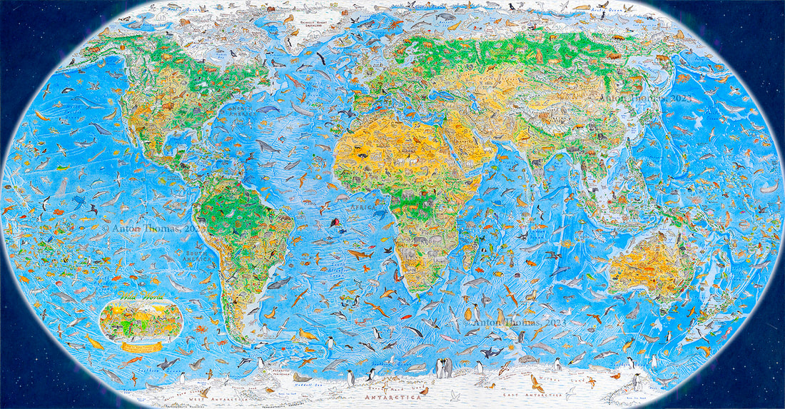
World map of illustrated animals

During a three-year span, Anton Thomas illustrated a world map of 1,642 animals native to each region. It’s called Wild World. The New York Times highlighted the work:
“We don’t see the latitude and longitude lines of maps,” he said. “We see the world, in our heads, through icons.”
For Mr. Thomas, this equates to a kind of “emotional geography,” where features with greater emotional heft — the New York City skyline, say, or the Golden Gate Bridge — may take up more space.
“There are animals the sizes of mountain ranges on my map,” he said. “But you know what? The African lion should tower over Kilimanjaro, if we’re drawing an emotional map.”
Prints for Wild World, among other illustrated maps, are available in Thomas’ shop.

