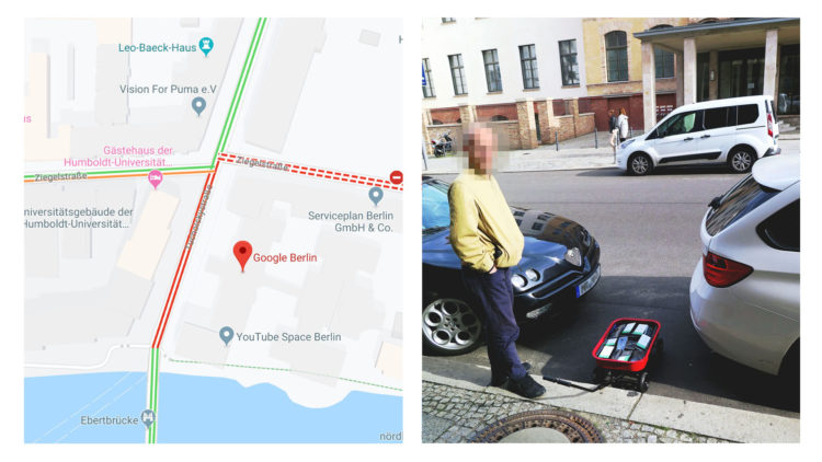
Google Maps incorporates data from smartphones to estimate traffic in any given location. Artist Simon Weckert used this tidbit to throw the statistical models off the scent. With a wagon of 99 smartphones, he turned roads red on Google Maps just by walking around.
Nice.
 Visualize This: The FlowingData Guide to Design, Visualization, and Statistics (2nd Edition)