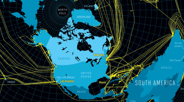
Nicolas Rapp, for Fortune Magazine, mapped the underwater cables that make the global Internet possible.
If the internet is a global phenomenon, it’s because there are fiber-optic cables underneath the ocean. Light goes in on one shore and comes out the other, making these tubes the fundamental conduit of information throughout the global village. To make the light travel enormous distances, thousands of volts of electricity are sent through the cable’s copper sleeve to power repeaters, each the size and roughly the shape of a 600-pound bluefin tuna.


 Visualize This: The FlowingData Guide to Design, Visualization, and Statistics (2nd Edition)

Is it just me, or does anyone else find it initially confusing when the land, rather than the water, is blue?
Yeah, it’s you. You get confused too easily.
I don’t mind the colours, it’s the azimuthal projection that bugs me.
The more interesting data is where the cables DON’T go. This could be interpreted as a map of economic activity potential.
The projection does seem like an odd choice.
Here’s a pretty nice interactive visualization using a mercator projection : http://submarine-cable-map-2012.telegeography.com/