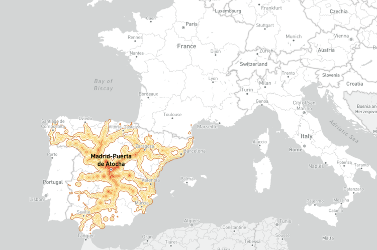
This European travel map by Benjamin Td shows how far you can travel in five hours, given a station location. Just hover over the map, and you see the areas, or isochrones that are reachable in five hours, assuming 20 minutes for interchanges.
The project is based on data from Deutsch Bahn, and was inspired by a more dotty map by Julius Tens. It reminds me of Tom Carden’s (now Flash-retired) travel time map from 2008.
I wonder what this would look like for the United States, but I am also a little scared to know.
 Visualize This: The FlowingData Guide to Design, Visualization, and Statistics (2nd Edition)