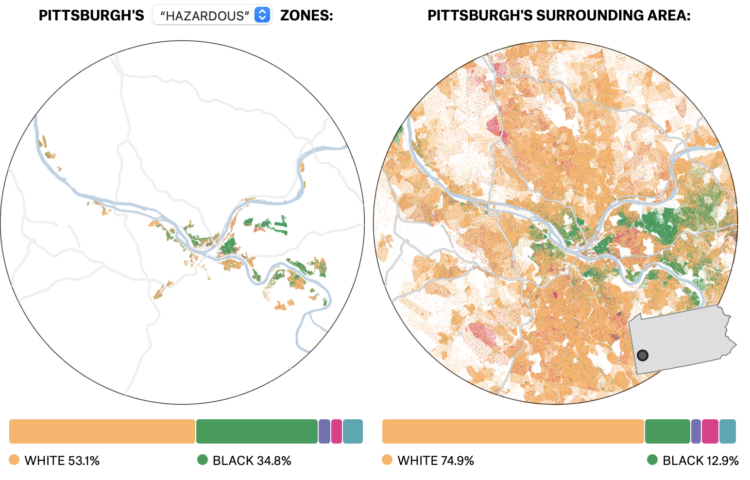
In the 1930s, a group called the Home Owners’ Loan Corporation went to cities classifying neighborhoods based on the “risk” of defaulting on loans. Areas deemed highest risk were marked with red ink on a map, and these areas tended to be non-white. The classification, redlining, was made illegal, but you can still see the effects today, as shown by Ryan Best and Elena Mejía with these interactive maps for FiveThirtyEight.
The maps are based on U.S. Census estimates and data from the University of Richmond’s Mapping Inequality project.

 Visualize This: The FlowingData Guide to Design, Visualization, and Statistics (2nd Edition)