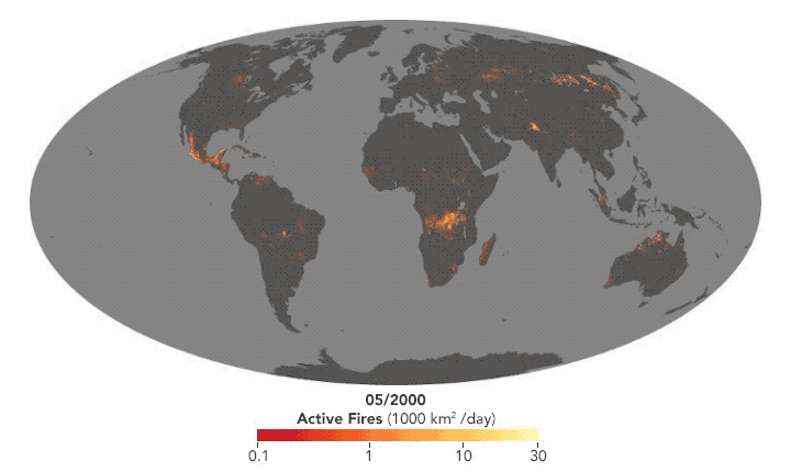
For the NASA Earth Observatory, Adam Voiland describes about two decades of fires:
The animation above shows the locations of actively burning fires on a monthly basis for nearly two decades. The maps are based on observations from the Moderate Resolution Imaging Spectroradiometer (MODIS) on NASA’s Terra satellite. The colors are based on a count of the number (not size) of fires observed within a 1,000-square-kilometer area. White pixels show the high end of the count—as many as 30 fires in a 1,000-square-kilometer area per day. Orange pixels show as many as 10 fires, while red areas show as few as 1 fire per day.
There are a lot of fires, but a bit surprising given the news lately, the total area burned each year is decreasing.
 Visualize This: The FlowingData Guide to Design, Visualization, and Statistics (2nd Edition)