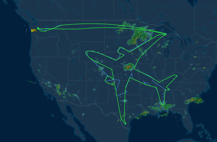
In a test flight, Boeing took the thing where you draw using your GPS path to a whole different level. They drew the outline of a plane that spanned the latitude of the conterminous United States.
Boeing draws a plane in the sky with flight path


In a test flight, Boeing took the thing where you draw using your GPS path to a whole different level. They drew the outline of a plane that spanned the latitude of the conterminous United States.