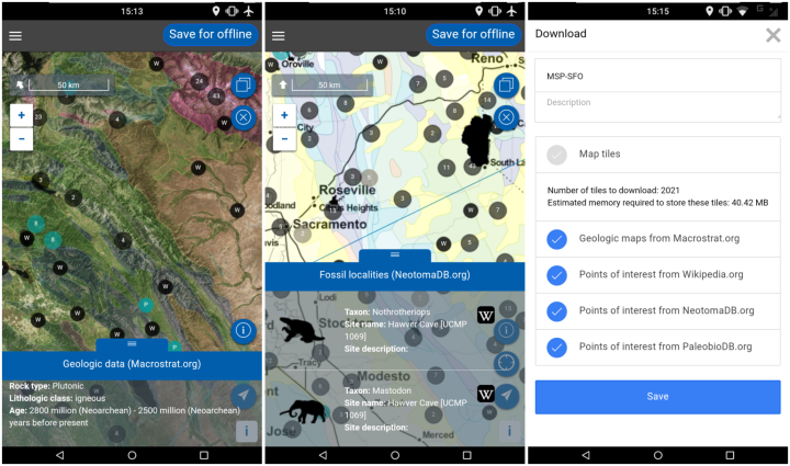
Before your next flight, road trip, or hike, download the Flyover Country app available for Android and iPhone. The app tells you information about where you are at any given moment, or if you’re flying, the ground beneath.
The app exposes interactive geologic maps from Macrostrat.org, fossil localities from Neotomadb.org and Paleobiodb.org, core sample localities from LacCore.org, Wikipedia articles, offline base maps, and the user’s current GPS determined location, altitude, speed, and heading. The app analyzes a given flight path and caches relevant map data and points of interest (POI), and displays these data during the flight, without in flight wifi.
 Visualize This: The FlowingData Guide to Design, Visualization, and Statistics (2nd Edition)