In collaboration between USGS, NASA and TIME, Google released a quarter century of satellite imagery to see how the world has changed over time.
The images were collected as part of an ongoing joint mission between the USGS and NASA called Landsat. Their satellites have been observing earth from space since the 1970s—with all of the images sent back to Earth and archived on USGS tape drives that look something like this example (courtesy of the USGS).
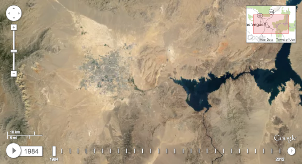
We started working with the USGS in 2009 to make this historic archive of earth imagery available online. Using Google Earth Engine technology, we sifted through 2,068,467 images—a total of 909 terabytes of data—to find the highest-quality pixels (e.g., those without clouds), for every year since 1984 and for every spot on Earth. We then compiled these into enormous planetary images, 1.78 terapixels each, one for each year.
Be sure to check out the Timelapse feature on Time.
 Visualize This: The FlowingData Guide to Design, Visualization, and Statistics (2nd Edition)