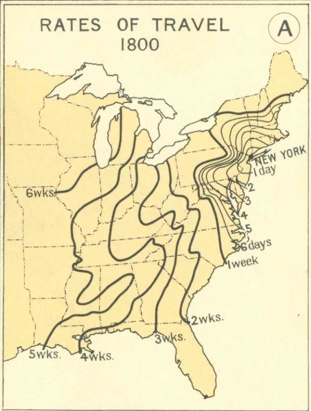
From the 1932 Atlas of the Historical Geography of the United States, these maps paint the picture of transportation in the 1800s. Each line represents how far one could travel in some amount of time, starting from New York. For example, it took about a month to get to Louisiana.
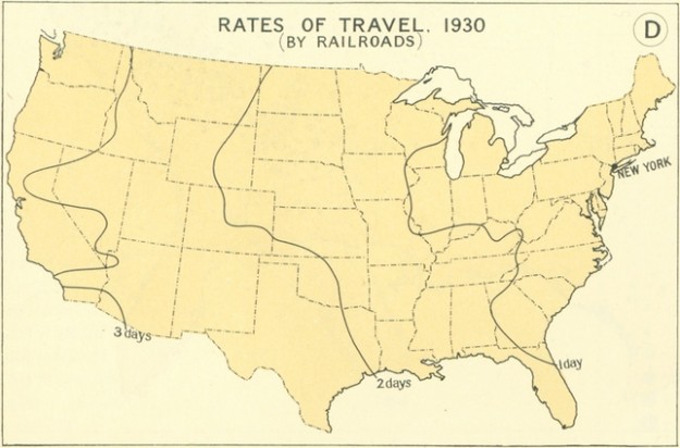
In contrast, here’s what travel by railroad in 1930 looked like:
[Thanks, Jonathan]
 Visualize This: The FlowingData Guide to Design, Visualization, and Statistics (2nd Edition)
Looks like the railroads are no better now than they were in 1930.
Quite a few have actually slowed down
It still takes FEMA a month to get to Louisiana
HAHA Man, that joke is so old.