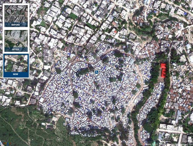
In memory of the devastating earthquake that hit Haiti one year ago on January 12, 2010, the New York Times shows aerial photos of Port-au-Prince from GeoEye and Google in this interactive. See views form before the earthquake, a few days after, and now.
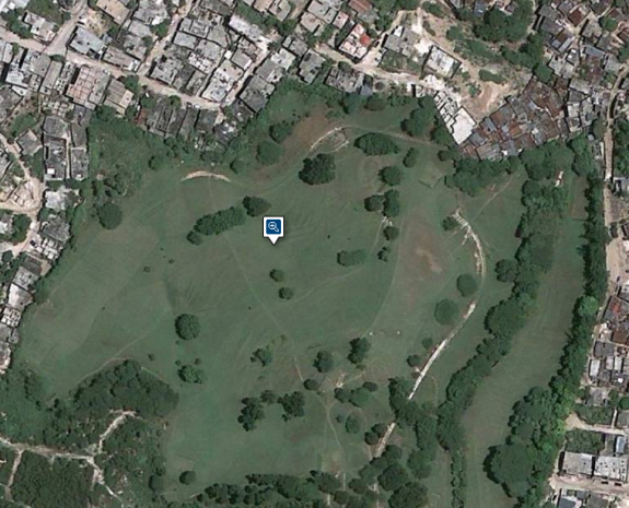
Above is a current view of the Pétionville tent city, a golf course that now houses an estimated 60,000 displaced Haitians. Here it is before the earthquake:

[New York Times via @mericson]


 Visualize This: The FlowingData Guide to Design, Visualization, and Statistics (2nd Edition)

The German magazine Spiegel Online shows similar pictures, too. (Not aerial but real photographs):
http://www.spiegel.de/flash/flash-25024.html
Pingback: ハイチの今とその時と(Destruction in Haiti, Then and Now) : monogocoro ものごころ
oh my it basically wiped out haiti homes! i feel so bad. i need to tell my organization what this picture really means. people you really need to help. you halped last year and now you dont even talk about it. like what the hack is yall prob. so if america had this damage your gonna walk around town like nothing happing. our president need to something. wyclif is! we need to make a change. i hate seeing pics like this it breaks my heart. think about the kids, scared to death. on the news it said the kids said” most of the population gone is mostly kids! omg!!!!! :( :( we need to donate so the kids could feel good and that we care even though its a foriegn country <3. and why doesnt the french help. they brought them there. and to let you know i am 11 yrs old. this is how me as a kid think.