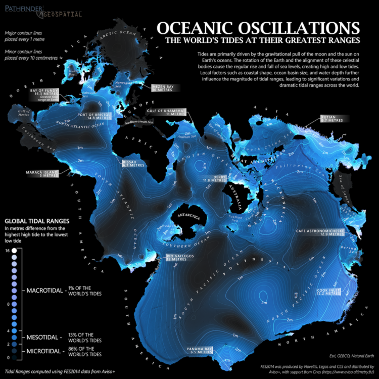
From Dave Taylor, this world map shows tidal ranges, from microtidal to macrotidal:
Created using FES2014 data from Aviso+, this map displays maximum tidal ranges (the difference between the lowest low tide and highest high tide) around the world. As tides are primarily an ocean phenomenon, the data is presented in an ocean-centric Spilhaus projection.
It’s soothing, almost like staring out at the ocean. In case you’re unfamiliar with the Spilhaus projection like I was, here’s more information. It emphasizes the connectedness of the large bodies of water surrounded by land instead of the other way around.
 Visualize This: The FlowingData Guide to Design, Visualization, and Statistics (2nd Edition)