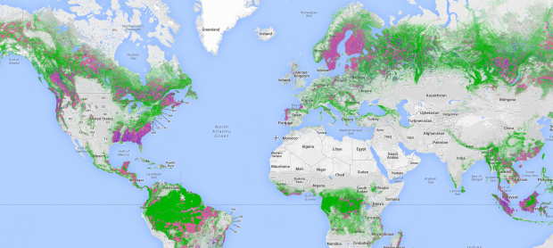
Global Forest Watch uses satellite imagery and other technologies to estimate forest usage, change, and tree cover (among other things). These estimates and their eventual actions used to be slow. Now they’re near-real-time.
This is about to change with the launch of Global Forest Watch—an online forest monitoring system created by the World Resources Institute, Google and a group of more than 40 partners. Global Forest Watch uses technologies including Google Earth Engine and Google Maps Engine to map the world’s forests with satellite imagery, detect changes in forest cover in near-real-time, and make this information freely available to anyone with Internet access.
Many layers and high granularity. Take your time with this one.


