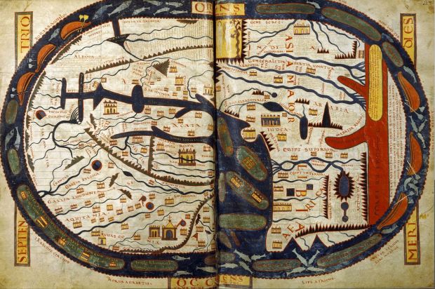
Amanda Uren has a fun collection of map-like scans from the 11th century. Some of them are geographic, but most of them are more like rough sketches of how the individual saw the area the image represents. It’s like those stereotype maps that people like to make, except no one’s trying to be funny.
Maps before maps
FlowingData Delivered to Your Inbox
2 Comments
Second Edition
 Visualize This: The FlowingData Guide to Design, Visualization, and Statistics (2nd Edition)
 Visualize This: The FlowingData Guide to Design, Visualization, and Statistics (2nd Edition)
New tools, refined process.
An interesting site. Too bad there are no dates. Also, people should remember that the convention was putting East at the top of the map, so you’ll likely have to twist your head to the left in order to recognize that this is a simplified version of the Med.
Cool stuff, though…
Very interesting indeed! These kind of maps inspired me and became the subject of my graduation project. If anyone’s interested, check out my interactive visualisation aimed to create an overall insight into the evolution of how man has presented the earth. A screencap can be found here: http://www.youtube.com/watch?v=041wyoDKijA&feature=youtu.be&hd=1
(If I may be so bold)